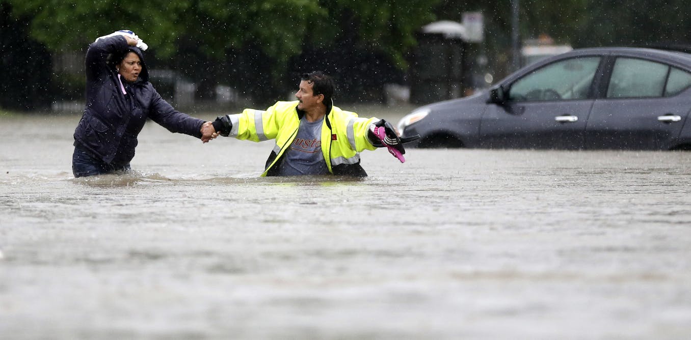
In April 2016, Houston experienced one of its most severe weather events: the Tax Day storm. Within 15 hours, nearly 24 inches of rain inundated parts of the region, leading to devastating floods. Some areas recorded rainfall levels that occur once in 10,000 years, as detailed in a Space City Weather analysis.
Despite the significant damage, the situation could have escalated further.
The storm’s heaviest rains impacted Waller County, located west of Houston, primarily affecting agricultural areas. If the same amount of rain had fallen over Houston’s urban center, the consequences would have been far more catastrophic.
This storm was particularly destructive due to its rapid onset, classified as a flash event that occurred without warning overnight.

AP Photo/David J. Phillip
Researchers at Rice University’s Center for Coastal Futures and Adaptive Resilience and the Severe Storm Prediction, Education and Evacuation from Disasters Center have utilized advanced hydrological models to predict the impact of similar storms on Houston’s urban areas today.
Findings indicate that current flood planning in Houston, and across the U.S., inadequately considers extreme, albeit rare, events. As climate change escalates, preparing for these low-probability yet high-impact scenarios becomes crucial.
The Limitations of Current Flood Risk Assessments
In the U.S., flood risk is assessed through FEMA’s flood maps, which influence emergency response and insurance programs. These maps typically identify areas at risk based on a 500-year flood probability, equating to a 0.2% chance of flooding annually.
This probabilistic model overlooks extreme events like the Tax Day flood, often deemed unrealistic due to insufficient historical data. However, Houston has experienced multiple severe floods in recent years, including the notorious Hurricane Harvey in 2017 and other 500-year floods.

AP Photo/David J. Phillip
Contrastingly, Dutch flood management emphasizes preparing for “worst credible floods,” acknowledging rare yet plausible catastrophic events. Their approach provides a framework for the U.S. to enhance its flood risk management.
Simulating the Tax Day Storm Today
Simulations by Rice University researchers assessed potential flooding if the Tax Day storm targeted Houston’s Clear Creek and Hunting Bayou watersheds.
Impact on Suburban Areas: If the storm had centered over Clear Creek, over 13,500 properties would have been flooded with 6 inches of water or more, posing significant safety risks and property damage. A vast majority of homes in this area lack flood insurance, amplifying potential financial losses.

Center for Coastal Futures and Adaptive Resilience/Rice University
Impact on Urban Areas: In Hunting Bayou, an area with historical infrastructure challenges, the Tax Day storm would have led to flooding of over 50% of residential lots with at least 6 inches of water, exacerbating the lack of flood insurance coverage in these areas.

Center for Coastal Futures and Adaptive Resilience/Rice University
These simulations, available on the Center for Coastal Resilience and Adaptive Futures website, underscore the potential for devastating floods that official planning often overlooks as improbable.
As extreme weather patterns become more frequent, the U.S. can adopt strategies from Dutch planning to enhance flood preparedness. This includes flexible planning, mapping potential disruptions, and raising public awareness of flood risks.
The 10-year anniversary of the Tax Day flood serves as a stark reminder of the need to address unlikely events proactively, utilizing scientific insights to protect urban areas from future climate challenges.
This article, originally published April 14, 2026, has been updated to include the Rice University SSPEED Center’s contribution to the research.